
Your Land, Mapped to the Killa.
ہر مربع، ہر کلہ — آپ کے موبائل پر
Digital mouza maps, centimetre-accurate RTK measurement and high-resolution drone imagery — everything you need to know, prove and plan your land in Punjab.
- No app install
- 24-hour free trial
- Urdu & English support
Four Services. One Clear Picture of Your Land.
Digital Land Maps
ڈیجیٹل نقشہ جات
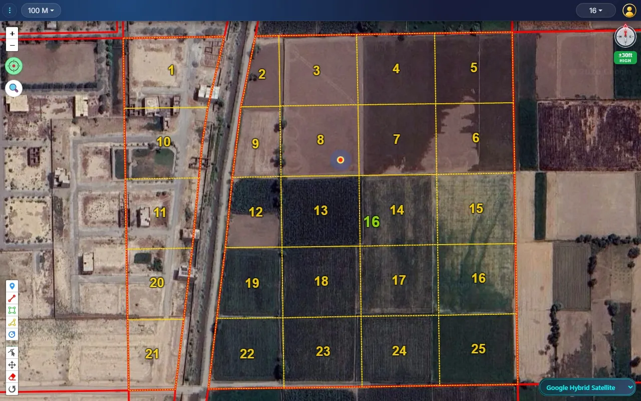
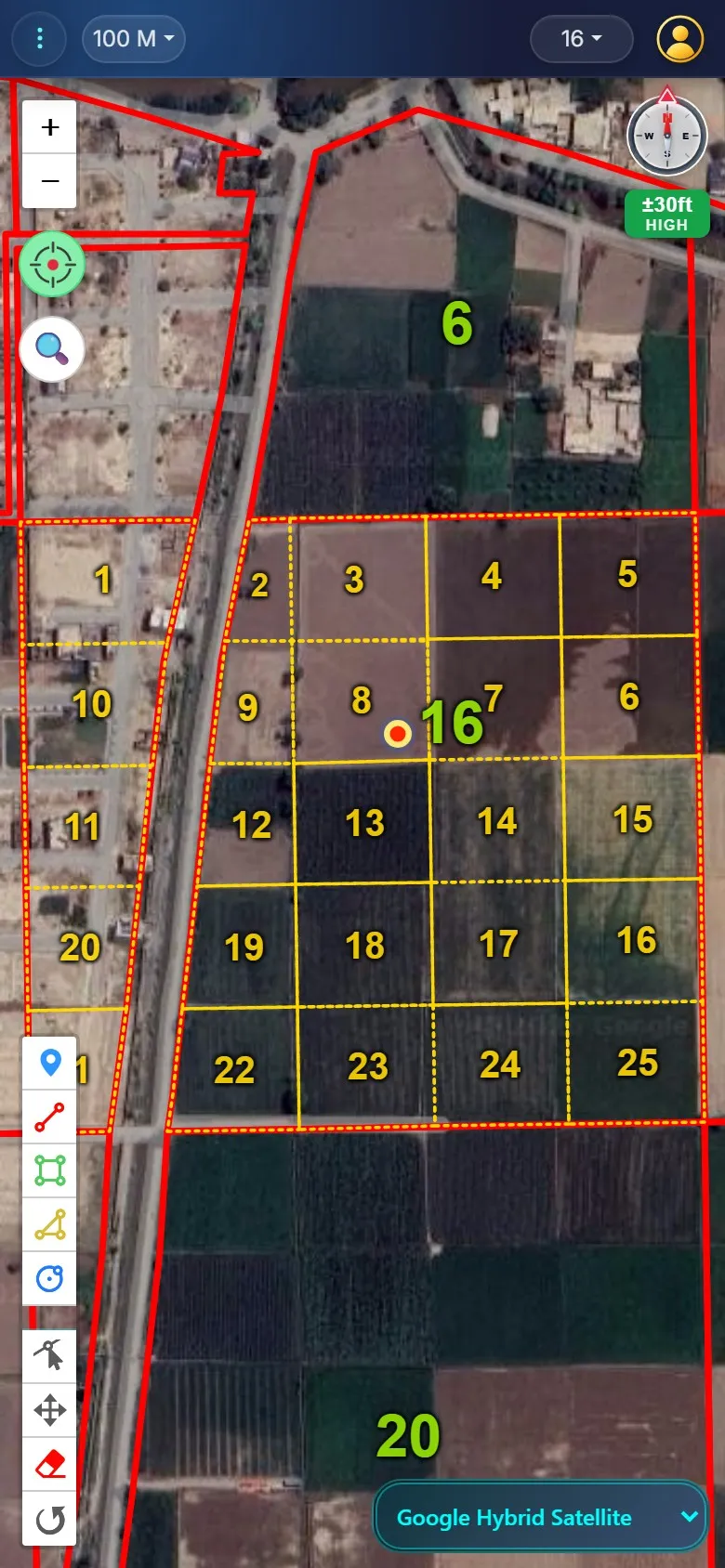
Mouza, murabba and killa boundaries overlaid on satellite imagery — searchable on any phone.
Learn moreRTK Land Measurement
آر ٹی کے پیمائش
Centimetre-accurate GNSS RTK surveys for demarcation, boundary disputes and plot layout.
Learn moreDrone Imagery
ڈرون سروے
Orthomosaic maps, DEM / DSM elevation models, contours, volume calculations, point clouds and 3D models of farms, schemes and sites.
Learn moreRevenue Record Consultancy
ریونیو ریکارڈ و زمینی تنازعات
Senior advice on old land disputes: mutations (intiqal), inheritance, partition, illegal possession and record correction.
Learn morePatwari-Level Detail, in Your Pocket.
Find Any Chak in Seconds
Pick tehsil, chak and murabba — the map flies straight to it.
“Which Killa Am I In?”
Live GPS shows your position on the killa grid while you walk the field.
Measure in Kanal & Marla
Draw any shape and get area in acres, kanal and marla instantly.
Satellite + Shajra Overlay
Switch base maps and overlay the shajra on current imagery.
Save & Export
Save your drawings, share locations and export maps for records.
Built for the Field
Works on any phone browser — no app install, no heavy downloads.
Roznamcha (Daily Diary)
Patwaris write each day’s events in the register format, search them and print a PDF — free with your account.
Free Inheritance Tools
Share calculator and shajra nasab for Sunni, Shia, Christian, Hindu, Sikh and Ahmadi law, with legal references.
Always the Latest Version
The dashboard updates itself when a new version is released, without losing your work.
From Question to Answer in a Day.
- 01
Tell Us Your Area
Share your tehsil and chak on WhatsApp or register online.
- 02
Get Dashboard Access
Your mouzas are activated — start with a free 24-hour trial.
- 03
Survey When You Need It
Book an RTK or drone team for on-ground demarcation and imagery.
Made for People Who Work the Land.
Landowners & Farmers
Know your exact killas and settle boundary questions with proof.
Lawyers & Property Dealers
Verify plots before deals and back cases with accurate maps.
Developers & Planners
Lay out housing schemes and roads on surveyed ground truth.
Frequently Asked Questions
What is Naqsha Zameen?
An online dashboard that shows mouza, murabba and killa boundaries on satellite imagery, with GPS location, area measurement and drawing tools — plus on-ground RTK and drone survey services by GeoMatrix Technologies.
Which areas do you cover?
We cover tehsils across Punjab and keep adding more. Message us your tehsil and chak on WhatsApp and we will confirm availability right away.
Do I need to install an app?
No. The dashboard runs in any modern phone or computer browser: just log in at dashboard.naqsha-zameen.com. If you like, tap "Install app" to add Naqsha Zameen to your home screen; the map, roznamcha, Share Calculator, Shajra Nasab and these pages then all open inside the app.
How accurate is the RTK measurement?
Our GNSS RTK equipment measures with centimetre-level accuracy under good conditions, suitable for demarcation, boundary disputes and plot layout.
Do you help with land disputes in the revenue record?
Yes. Our senior revenue-record consultants advise on old land disputes: mutations (intiqal), inheritance (wirasat), partition (taqseem), illegal possession and encroachment (qabza), and record correction (fard badr). They work alongside your advocate.
Can I try before paying?
Yes. Register online for a free 24-hour trial, then choose a monthly or yearly plan.
Ready to See Your Land Clearly?
Start a free 24-hour trial of the dashboard, or message us on WhatsApp to book an RTK or drone survey.
